Onyx Summit 8443'
San Bernardino National Forest
|
||||||
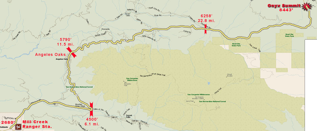
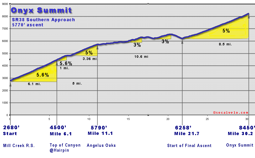
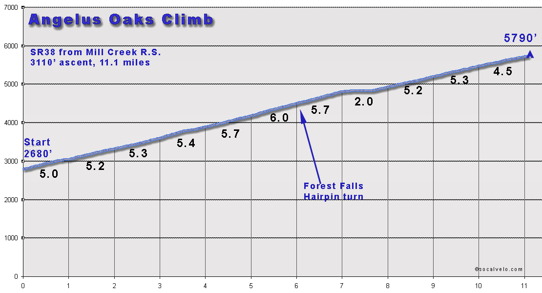
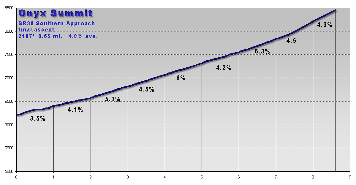
While not as steep as other Socal climbs, this is a long one at 31 miles. The climb is broken up by some downhill sections about half way up. There are four distinct sections starting from the Mill Creek Ranger Station on Highway 38. About two thirds of the way up you encounter some downhills in the Barton Flats area. This route starts at the corner of State Route 38 (Mill Creek Road) next to the Mill Creek Ranger Station at the intersection with Bryant, north of Yucaipa. Onyx Summit is the highest paved road in Southern California. |
|
|||||
miles |
% Grade |
Start Elev |
End Elev |
Gain |
||
| Total Climb - Mill Creek Ranger Sta. to Onyx Summit | 30.2 |
4* |
2680 |
8450 |
57577087
|
|
| * % climbing is approx 5%. | ||||||
 |
||||||
 |
||||||
 |
||||||